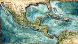
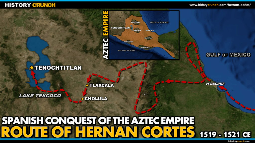
When Hernan Cortes set sail from Cuba in 1519 with approximately 11 ships and just over 500 men, he embarked on one of the most consequential journeys in the history of the Americas. His route from the coast of Mexico to the Aztec capital of Tenochtitlan took him through the territories of multiple Mesoamerican peoples, shaped the alliances that would determine the outcome of the conquest, and ultimately ended with the fall of one of the greatest civilizations in the New World. This map was created by History Crunch to help students visualize the geographic route of Hernan Cortes and is based on the History Crunch article titled Hernan Cortes.
Map of the Route of Hernan Cortes to Conquer the Aztec
About This Map
This map of the route of Hernan Cortes to conquer the Aztec was created by the History Crunch team to help students and teachers understand the geographic dimensions of the Spanish conquest of the Aztec Empire. It is designed as a visual learning tool to accompany our full articles on Hernan Cortes and the Spanish Conquest of the Aztec Empire. Teachers may use it as a classroom display, a geography activity, or a discussion starter about the events and decisions that shaped the conquest.
What This Map Shows
The map traces the route of Hernan Cortes from his departure point in Cuba to his eventual capture of Tenochtitlan in 1521. The journey began when Cortes set sail in early 1519, defying orders from Diego Velasquez, the Spanish governor of Cuba, who had tried to cancel the expedition. Cortes sailed across the Gulf of Mexico and first arrived on the coast of the Yucatan Peninsula, to the east of the main territory of the Aztec Empire.
The map shows the early stages of the expedition along the Gulf Coast of Mexico, where Cortes and his men first encountered various Mesoamerican peoples. One of the most significant early events shown on the map is Cortes’s contact with the Tlaxcala, a powerful city-state located to the east of Tenochtitlan. The Tlaxcala were traditional enemies of the Aztec and had long resisted Aztec domination. Recognizing an opportunity, they allied themselves with the Spanish against the Aztec. This alliance proved absolutely critical to the conquest, as it gave Cortes thousands of experienced Mesoamerican warriors and an intimate knowledge of Aztec territory, politics and military methods.
The map also shows the route Cortes took as he moved westward through Mesoamerica toward the Valley of Mexico and the Aztec heartland. Along the way he continued building alliances with other groups who resented Aztec rule, steadily increasing the size and strength of his force. The Aztec ruler Moctezuma II was kept informed of the Spanish advance but initially chose to welcome Cortes rather than resist him, partly because Cortes’s arrival coincided with an Aztec prophecy about the return of the god Quetzalcoatl. The map marks the arrival of Cortes at Tenochtitlan in November 1519, when he entered the Aztec capital as a guest of Moctezuma II.
Finally the map shows the later stages of the conquest, including the route of the Spanish retreat during Noche Triste on July 1st, 1520, when Cortes and his men fled Tenochtitlan under cover of darkness after the Aztec uprising. The Spanish retreated to Tlaxcala where they regrouped, received reinforcements and planned their final assault. The map marks the return of Cortes to the Valley of Mexico in late 1520 and the beginning of the final siege of Tenochtitlan, which ended with the fall of the city on August 13th, 1521.
How to Use This Map in the Classroom
This map works well as a visual companion to any lesson on the Spanish conquest of the Aztec Empire. It can be used as a geography activity asking students to trace the route of Cortes and identify key locations along the way, including the Yucatan Peninsula, Tlaxcala and Tenochtitlan. Teachers may also use it as a discussion prompt asking students to consider how geography shaped the decisions Cortes made during the conquest, or why the alliance with the Tlaxcala was so important to the eventual Spanish victory. It pairs particularly well with the Spanish Conquest of the Aztec Empire infographic and the map of the Aztec Empire and Aztec Triple Alliance to give students a complete visual picture of the conquest.
Related Articles
To learn more about the topics covered in this map, visit the following History Crunch articles: