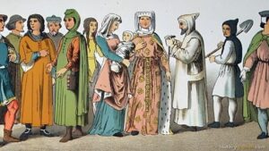
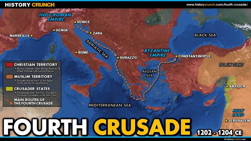
The Fourth Crusade took place from 1202 to 1204 CE and stands apart from all other crusades as one of the most unusual and controversial events of the Middle Ages. Originally called by Pope Innocent III in 1198 with the goal of attacking Egypt and ultimately reclaiming Jerusalem, the Fourth Crusade was dramatically diverted from its intended destination and instead ended with European crusaders sacking Constantinople, the capital of the Christian Byzantine Empire. This map was created by History Crunch to help students visualize the geographic route and diversion of the Fourth Crusade and is based on the History Crunch article titled Fourth Crusade.
Fourth Crusade Map
About This Map
This Fourth Crusade map was created by the History Crunch team to help students and teachers understand the geographic dimensions of one of the most extraordinary and controversial events in the history of the Crusades. It is designed as a visual learning tool to accompany our full article on the Fourth Crusade. Teachers may use it as a classroom display, a geography activity, or a discussion starter about how and why the Fourth Crusade ended up so far from its intended destination.
What This Map Shows
The map shows the intended route of the Fourth Crusade and the actual route it followed, illustrating the dramatic divergence between the original plan and what actually happened. The original plan was to attack Egypt, which was the main center of Muslim power in the Middle East at the time. The crusaders believed that capturing Egypt would give them a strategic base from which to eventually reclaim Jerusalem. Since Egypt required a sea approach, the crusaders needed ships, and they reached an agreement with the powerful city-state of Venice in 1201 to provide a fleet for the campaign.
The map shows Venice as the critical starting point and turning point of the Fourth Crusade. The agreement with Venice required the crusaders to pay a substantial sum for the ships, but when the crusaders gathered in Venice they did not have enough men or money to fulfill their side of the agreement. The Venetians, led by the elderly but powerful Doge Enrico Dandolo, proposed an alternative arrangement: the crusaders would help Venice recapture the city of Zara on the eastern Adriatic coast, which had recently fallen under the control of the King of Hungary. The map shows the location of Zara on the Dalmatian coast and the short diversion the crusaders made to capture it in 1202, an act that drew condemnation from Pope Innocent III since Zara was a Christian city.
The most dramatic diversion shown on the map is the route to Constantinople. A Byzantine prince named Alexios Angelos, whose father had been deposed as Byzantine Emperor, approached the crusaders and promised them enormous rewards including money, military support and the reunification of the Eastern and Western Christian churches if they helped him reclaim the throne. The crusaders agreed and the map shows their route from the Adriatic across the Aegean Sea to Constantinople. They arrived at the Byzantine capital in 1203 and initially installed Alexios on the throne. However, Alexios was unable to fulfill his promises and was subsequently overthrown in an internal coup. In April of 1204, frustrated and unpaid, the crusaders sacked Constantinople, looting its vast treasures and weakening the Byzantine Empire so severely that it never fully recovered.
The Fourth Crusade never reached Egypt or the Holy Land at all. Its route shown on the map traces a journey that began in western Europe, stopped at Venice, diverted to Zara, and ended at Constantinople, thousands of miles from the original destination of Egypt.
How to Use This Map in the Classroom
This map works well as a visual introduction to the Fourth Crusade before students read the full article. It can be used as a geography activity asking students to compare the intended route to Egypt with the actual route to Constantinople and identify the key locations of Venice, Zara and Constantinople. Teachers may also use it as a discussion prompt asking students to consider how and why the Fourth Crusade was diverted so dramatically from its original purpose, and what this tells us about the political and financial pressures that shaped the crusading movement. It pairs particularly well with the Third Crusade map to help students understand how the momentum and direction of the crusades shifted over time.
Related Articles
To learn more about the topics covered in this map, visit the following History Crunch articles: