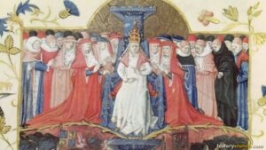
The First Crusade was one of the most significant military expeditions in the history of the Middle Ages. Beginning in 1096 CE following a call to arms by Pope Urban II, thousands of European knights, nobles and peasants made the long and dangerous journey from western Europe through the Byzantine Empire and into the Holy Land. The crusaders captured Jerusalem in July of 1099 and established a series of Crusader States in the eastern Mediterranean that would shape the history of the region for the next two centuries. This map was created by History Crunch to help students visualize the geographic route of the First Crusade and is based on the History Crunch articles on the Crusades.
First Crusade Map
About This Map
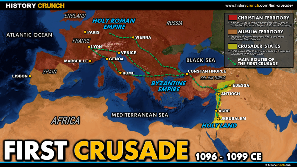
This First Crusade map was created by the History Crunch team to help students and teachers understand the geographic dimensions of the First Crusade. It is designed as a visual learning tool to accompany our full articles on the First Crusade and the broader history of the Crusades. Teachers may use it as a classroom display, a geography activity, or a discussion starter about the religious, political and military forces that drove thousands of Europeans to travel thousands of miles to fight for control of the Holy Land.
What This Map Shows
The map shows the routes taken by the main armies of the First Crusade as they traveled from their starting points in western Europe eastward toward the Holy Land. The crusaders came from many different regions across Europe including France, Germany, England and Italy. Historians estimate the main armies totaled approximately 35,000 crusaders and 5,000 cavalry, including nobility, knights and commoners. Most made their way toward Constantinople, the capital of the Byzantine Empire, where they regrouped and resupplied before pushing further east.
The map highlights Constantinople as the crucial staging point of the First Crusade. Pope Urban II had called for the crusade in part to assist the Byzantine Empire, which had recently lost Anatolia (modern-day Turkey and Syria) to the Seljuk Turks. The crusaders arrived at Constantinople in late 1096 CE and, after negotiations with the Byzantine Emperor, crossed into Anatolia to begin their campaign against Muslim forces.
The map also shows the key territories captured by the crusaders on their route toward Jerusalem. As the crusaders advanced through the eastern Mediterranean they established a series of Crusader States to control conquered territory and serve as bases for further operations. The main Crusader States established during the First Crusade were the County of Edessa, the Principality of Antioch, the Kingdom of Jerusalem and the County of Tripoli. These states are all located in the area of the eastern Mediterranean and became vital waypoints for European crusaders in the decades that followed.
The final destination shown on the map is Jerusalem itself, which the crusaders captured in July of 1099 after a prolonged siege. The fall of Jerusalem was the defining moment of the First Crusade and became a powerful symbol that inspired the eight further crusades that followed over the next two centuries. However, as the map illustrates, the enormous geographic distances involved in reaching Jerusalem from western Europe made sustaining crusader control of the region an enormous ongoing challenge.
How to Use This Map in the Classroom
This map works well as a visual introduction to the First Crusade before students read the full article. It can be used as a geography activity asking students to trace the route of the crusaders from western Europe to Jerusalem and identify the key territories and city-states along the way. Teachers may also use it as a discussion prompt asking students to consider the enormous logistical and geographic challenges the crusaders faced in traveling thousands of miles to reach the Holy Land. It pairs particularly well with the Crusades overview article and the articles on the individual Crusader States to give students a complete picture of the First Crusade.
Related Articles
To learn more about the topics covered in this map, visit the following History Crunch articles: